
I - Introduction
Eagloo is an open-source scientific software developed in Python that allows for several necessary steps in the processing of Digital Terrain Models (DTMs). Eagloo was originally developed to facilitate the co-registration of DTMs for glaciers, but it can be used in other areas as well.
II - Software's utilities
Specifically, Eagloo allows for:
- - Co-registration of DTMs using different methods: Nuth and Kääb algorithm (Nuth and Kääb, 2011), Iterative Closest Point (ICP) algorithm, Deramp algorithm, Vertical offset algorithm
- - Subtraction of DTMs to calculate the volume difference between two layers
- - Interpolation of missing data using linear interpolation, hypsometric interpolation, and local hypsometric interpolation methods
- - Calculation of errors through those different methods: unstandardized non-stationnarity errors, standardized non-stationnarity errors and integrated and mean standardized error
- - Calculation of the accumulated or lost ice volume and mass
- - Generation of a PDF displaying the maps and major data generated through this process
The frontend of the software was developed using the PySimpleGui framework. This choice was made to focus on the backend and thus allow for a longer development period.
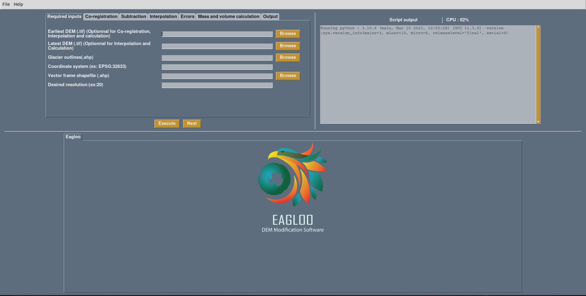
Figure 1: Frontend of the Eagloo software
III - Example report
If you want to observe an example of a report, you can click below.
Bibliography:
Nuth, C. and Kääb, A.: Co-registration and bias corrections of satellite elevation data sets for quantifying glacier thickness change, The Cryosphere, 5, 271–290, tc.copernicus.org/articles/5/271/2011/ , 2011.
You can find more information by clicking on the following link: