1 - Introduction
The objective was to collect data to characterize a portion of the James Bay watershed located in the western region of northern Quebec. This project was carried out within the Groundwater Research Group (GRES) at the Université du Québec en Abitibi-Témiscamingue (UQAT) for a thesis work. The studied watershed is located in the southwest (No. 08) of the map presented below (Figure 1).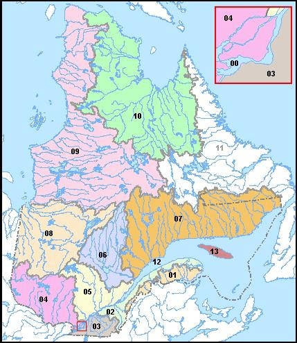
Figure 1: Map showing the major Quebec watersheds.
2 - Work carried out
A - Measurement of flow rate.
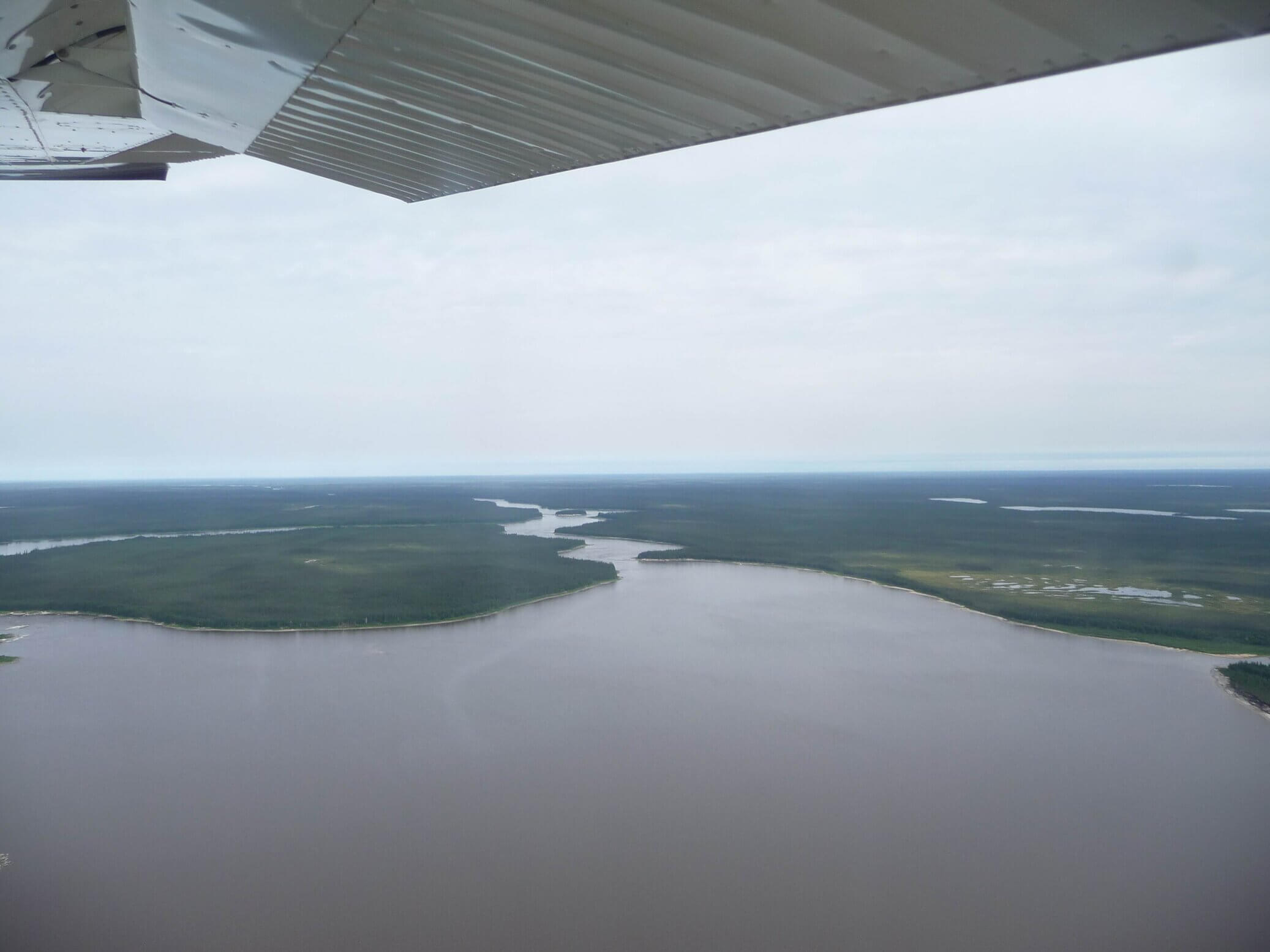
We carried out a series of measurements on all the rivers of the watershed to be characterized, at various times of the year and at different geographical points. To carry out these measurements, we used an "Acoustic Doppler Current Profiler" (ADCP). We fixed this device at the front of an inflatable boat of the "Zodiac" type.
Figure 2: Static flow rate measurement (by towing the boat with two ropes) with the ADCP (located at the front of the boat).
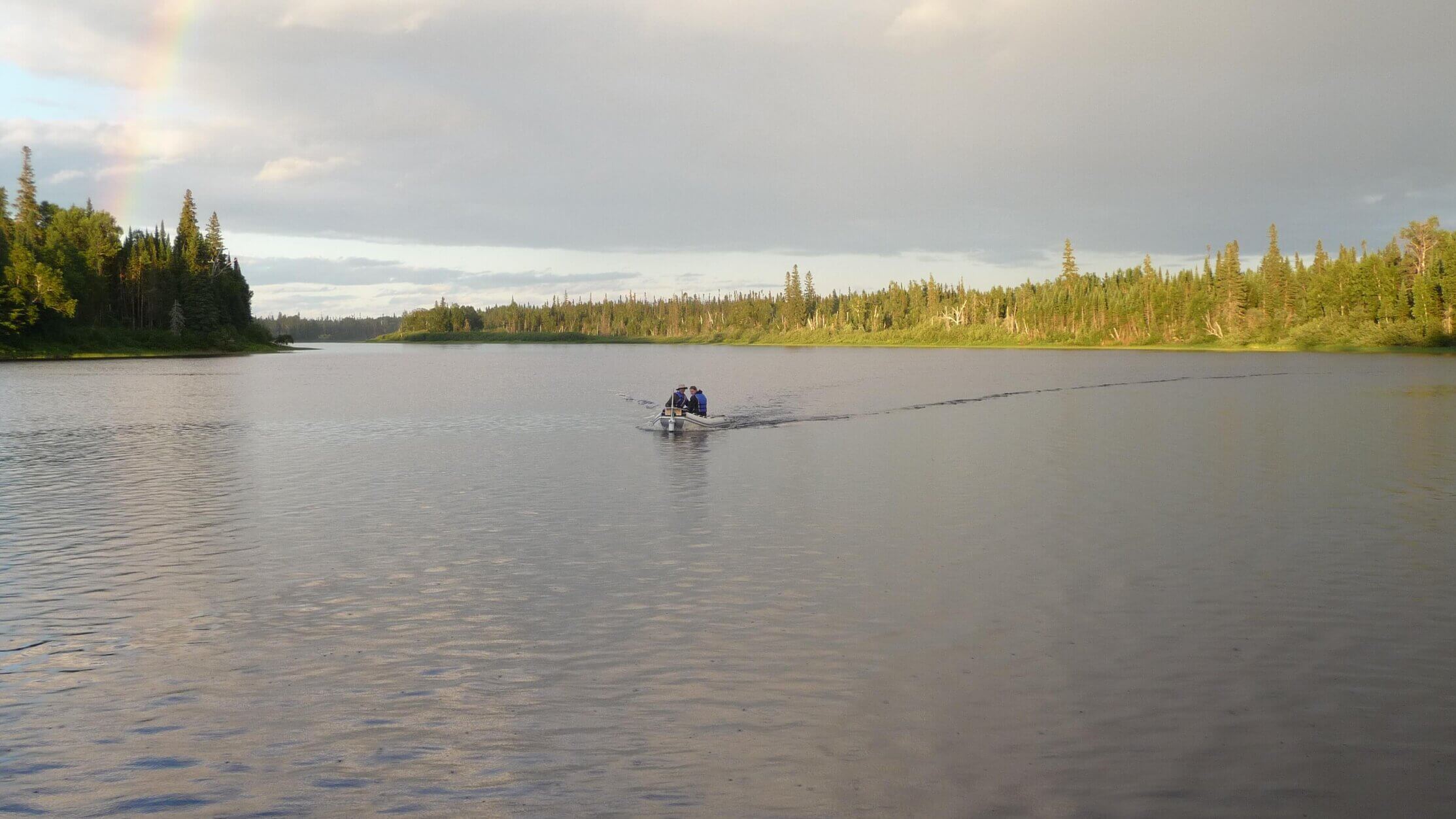
Figure 3: Dynamic flow rate measurement (by directly piloting the boat).
To obtain a reliable flow rate measurement, it is necessary to trace a trajectory that is as close as possible to perpendicular to the direction of the watercourse.

Figure 4: Flow profile for the Bell River at Lebel-sur-Quévillon.
B - The isotopic composition of water
One objective of this study is to determine the water input at the following levels:
- - precipitation
- - surface runoff
- - springs and seepage
- - snowmelt
To achieve this, we collected water samples from all the areas where flow measurements were made. The objective was to study the isotopic composition of water molecules, as the isotopes and their concentration can provide information on the different sources mentioned above. For example, the concentration of tritium, a radioactive isotope of hydrogen, can be used to determine the duration associated with its liquid state in an aquifer (up to 60 years).
C - Ice core cutting
During the winter, ice cores were collected from different areas on the rivers in the study area. Each sample was cut into pieces of about 5 cm. They were then sent to an analytical laboratory to determine their isotopic composition.

Figure 5: Cutting of ice cores collected from rivers during the previous winter.
You can find more information by clicking on the following link: